The difference between absolute and relative altitude. The image on the plan of the unevenness of the earth's surface
The surface of our planet is uneven: some of its parts are higher, others are lower; meet high mountains, deep depressions, vast plains. The irregularities of the earth's surface are called. How to show relief on paper? Obviously, first of all, it is necessary to measure the height of the hills and the depth of the depressions.
Relative height
A small height can be measured using a level device. You can make a simple level yourself. It is a wooden block 1 m long with a transverse bar attached to its end. A nail is driven into the middle of the bar and a plumb line is tied to it - a thin but strong thread with a small load, by which it can be judged whether the level is installed vertically or obliquely. To measure, for example, the height of a hill, the leveler sets the level at its sole strictly vertically, along a plumb line. The horizontal bar of the level should be directed towards the slope of the hill. Looking along the bar, the leveler notices where it is directed. At this point, the assistant leveler drives in the first peg. Since the height of the level is 1 m, the driven peg is 1 m above the place where the level is installed. Then the leveler moves the level to the place of the first peg and indicates to the assistant where to drive the second peg.
Points - this is the excess of this point on the earth's surface over another along a plumb line.
Altitude
The figure shows a hill, the sole of which is higher on one side than on the other. Consequently, the relative height of the top of this hill is not the same on its different sides. The top of a hill can have several relative heights. How to show this on the map? To avoid confusion, scientists agreed to count all heights and depths from some constant level - the average sea (ocean) level, taken as 0. The height measured from this level is always the same.
The absolute height of a point is the excess of this point on the earth's surface along a plumb line above sea level.
True, there are difficulties regarding which level to take as the mean sea level: in different seas and oceans, along different coasts, the water level is not the same (due to currents, the shape of the coasts, the rotation of the Earth, etc.). In Russia, the absolute heights of all points are measured from the level near Kronstadt. Other countries have their own points of reference absolute heights.
Horizontals (isohypses)
To indicate on the map not only the height of individual points on the earth's surface, but also to depict entire spaces that have a convex or concave shape, special lines are used.
For clarity, imagine that a hill during a flood is flooded with rising water. The rise of water occurs gradually, and different levels of standing water can be drawn on the surface of the hill. When looking at the hill from above, the water levels will look like closed and, as it were, nested curves. These are the horizontals.
CHAPTERIIISHELLS OF THE EARTH
Topic 1LITHOSPHERE
§24. TERRAIN ALTITUDE AND RELATIVE HEIGHT
Remember how you can measure the height of an object.
What are the surface shapes in your area?
You already know that the earth's surface is uneven. It has relatively flat areas, there are ups and downs - hills, mountains, ravines. To represent the unevenness of the earth's surface and show them on a plan or map, you need to know the height of the hills and the depth of the depressions in the surface.
HOW RELATIVE HEIGHT IS MEASURED. To determine the height of, for example, a hillock on the ground, you need to measure the vertical distance from its sole to the top. This can be done with a leveler. The level is a simple device in the form of a vertical rail 1 m high and a horizontal bar with a plumb line (drawer).
The method of measuring their height is shown in fig. 87. First, a level is installed at the bottom of the hill. Behind the plumb line, its verticality is checked. The horizontal bar of the level is directed to the slope. They “aim” in the direction of the bar and notice the point on the slope to which it is directed. A peg is hammered there. If the height of the level is 1 m, this point will be 1 m higher from where the level is located. After that, the level is transferred to the stake and "aim" at another point up the slope. The second point will already be 2 m above the sole. So sequentially rearrange the level several times along the slope. Having reached the top, the height of the hill in meters is determined by the number of pegs.
Thus, they find out how many meters one point (in our example, the top of the hill) is higher relative to the other (the bottom of the hill). The excess of one point on the earth's surface above another is called relative height.
Measurement of the height of points on the earth's surface is called leveling (Fig. 88). With the help of a level, you can measure the height of the river bank above the water, the height of the slope of the ravine above its bottom, and the like. The relative height needs to be known to scientists, builders, tourists.
School level

Rice. 87. Relative height measurements

Rice. 88. Leveling
HOW ABSOLUTE HEIGHT IS DETERMINED. If you carefully consider Fig. 88, you will see that on one slope of the hill the level was set four times, on the slope on the other side - five times. This means that the sole hump on one eye may be lower than on the other. Therefore, the relative height of the peak, measured on different sides of the hill, may not be the same.
To avoid inconsistency in heights, on plans and maps they indicate not a relative height, but an absolute one. It is measured from a single level - sea level, which is considered to be zero. Therefore, the absolute height is the excess of a point on the earth's surface above sea level, which affects 0. However different seas have different level. Which one should be counted from? In Ukraine, as in other countries (Russia, Belarus, Moldova, etc.), it is customary to count the absolute height of surface points from the level of the Baltic Sea (Fig. 89).
To determine the absolute height of the points, it is not necessary to go to its shores. In various places on the ground, special signs are placed - benchmarks (Fig. 90). They indicate the height of this section above the level of the Baltic Sea. From this sign, by leveling, you can determine the height of any point. For example, the absolute height of Kyiv (its highest part - Pechersk) is 190 m.
On plans and maps, the absolute height of a single point in the terrain is indicated by a dot.
Near it write the height in meters. This is the height mark (Fig. 92).

Rice. 89. Altitude reading

Rice. 9 0. Rapper
 Rice. 91.


Rice. 93. Image of surface irregularities on a plane using contour lines

Rice. 94. Images of contour lines on the plan
HOW SURFACE IRREGULARITIES ARE SHOWN BY HORIZONTS. Roughnesses of the earth's surface on plans and maps are depicted as horizontal lines. Contours are lines on a plan or map connecting points on the earth's surface with the same absolute height. They outline the shape of the irregularities of the earth's surface. So, the marks of the absolute heights of the hill are transferred to the plan and connected by lines with other similar height marks (Fig. 93, 94).
On the plan, the horizontals are depicted by lines of pink or brown. They are carried out at certain intervals. For example, through the skin 5,10, 20, 50, 100 or 200m. On the horizontal line, the number indicates the absolute height.
Please note: the distance between contour lines depends on the steepness of the slopes. If the slope is steep, the contour lines on the plan will be drawn close to each other, if the slope is gentle - at a greater distance. Small dashes drawn perpendicular to the horizontal are called berghash. With the free end, they indicate in which direction the slope goes down. Horizontals on the plans depict not only rise, but also depressions. Then the berghashes will be directed with their free end inside the contour.
Behind the horizontals on the plan, you can decide practical matters. For example, one has only to look at the plan to determine in which direction the terrain rises, which slope of the hill is steeper, a certain object is visible from one point or another.

Image of berghashes on contour lines
On the map, the contour lines are drawn through several meters as on the plan, and through hundreds of meters and through different intervals of height (on the map of the hemispheres - 0, 200 m, 500 m, 2000 m, etc.). For greater clarity, the area between the horizontals is painted with various colors. Sections with absolute heights from 0 to 200 m are shaded in green, from 200 to 500 m - yellow, over 500 m - shades of brown. Same horizontal lines and shades blue color the depths of the oceans and seas are shown. As you already know, the colors used on the map are explained by the scale of heights and depths.
Despite the relative and absolute heights, the highest mountain in the world is not Everest (8850 m), but the Mauna Kea volcano in the Havana Islands. Its absolute height is 4205 m (above sea level), and its relative height is 9705 m (from the foot at the bottom of the ocean to the top).
REMEMBER
height is the excess of one point on the earth's surface above another.
Absolute height is the elevation of a point on the earth's surface above sea level.
Contours are lines on a plan or map connecting points of the same absolute height.
Bergstroke - a dash drawn perpendicular to the horizontal and indicates with its free end in which direction the slope goes down.
QUESTIONS AND TASKS
1. What is the difference between relative height and absolute height?
2. What does the height mark on the plan mean?
3. What do the horizontals on the plan represent?
4. Determine at what distance from each other the horizontal lines are drawn in fig. 93.
5. What is the relationship between the steepness of the slope and the distance between contour lines?
6. How does a hill differ from a depression in terms of image?
7. Calculate the relative height of the hill if its absolute height is 487 m, and the horizontal near the base is drawn at a height of 230 m.
8. How would the absolute height of Mount Hoverla change if the water level in the Baltic Sea rose by 10 m?
PRACTICAL WORK 4
Topic: Determination of the absolute and relative height of the terrain using maps.
1. Using the physical map of the hemispheres, on the scale of heights, determine:
a) the absolute height of the Brazilian plateau and its height relative to the Amazonian lowland;
b) the absolute height of the Ural Mountains and their height relative to the West Siberian Plain.
2. Using the physical map of the hemispheres, determine the height marks:
a) the absolute height of Mount Kilimanjaro in Africa;
b) the absolute height of Mount Chomolungma (Everest), which is in Asia.
Majestic mountains and endless plains, high cones of volcanoes and deep intermountain valleys, sandy hills and ravines - such diverse forms of the land surface. The irregularities of the continental and oceanic crust are very different. They are distinguished by shape, size, origin, age. There are convex forms (hills, mountains), concave (ravines, valleys, depressions), flat and hilly. The totality of the forms of the earth's surface is called relief. The varied terrain is the result of the interaction of internal processes that create irregularities, and external ones that try to even them out.
If we imagine the surface of the planet without ocean water, we will see the largest landforms of the earth's crust: the depressions of the oceans and the continents rise above them. These inequalities determine the "face" of the planet, so they are called planetary landforms (largest). And on the continents and at the bottom of the oceans, the main landforms (large) are plains and mountains. they are complicated by smaller forms - hills and valleys, hillocks and ravines, etc. (Fig. 95).

Rice. 95 Dividing landforms
Question 1. What are conventional signs?
Cartographic conventional signs - a system of symbolic graphic designations used to depict various objects and phenomena on maps, their qualitative and quantitative characteristics.
Question 2. What are the types of symbols?
There are three types of conventional signs: 1) Large-scale: forest, swamp, mountains, plains; 2) Off-scale: minerals, cities; 3) Linear: roads, rivers, borders.
Question 3. What is the difference between the image of the unevenness of the earth's surface on geographical and topographic maps?
The relief on topographic maps is depicted by horizontal lines in combination with conventional signs of cliffs, rocks, and ravines. The relief image is supplemented with height marks of characteristic points of the terrain, contour lines, relative heights (depths) and slope direction indicators. On the geographical map the relief is depicted by contour lines, that is, curved closed lines, the points of which are located on the ground at the same height above sea level.
Question 4. What is relief?
The surface of the earth is uneven. It has hills and ravines, mountains and plains. These irregularities are called relief. The relief is all the irregularities of the earth's surface, which have different sizes, shapes, origins and are formed as a result of the simultaneous action of internal and external forces.
Question 5. What is relative height?
Relative height is the excess of one point on the earth's surface above another.
Question 6. What is the absolute height?
Absolute height is the elevation of a point on the earth's surface above sea level.
Question 7. What is a horizontal line?
Contours - lines connecting points with the same absolute height and spaced from each other by the same vertical distance. The closer the horizontals are, the steeper the slopes of hills and depressions.
Question 8. How to distinguish a hill from a depression on a topographic map?
For this, there is a special line on the horizontal, which is called a berg-stroke. The dashes are drawn perpendicular to the horizontal lines and directed down the slope. On the image of the hill they are directed from the top to the bottom, and on the image of the depression - from its edge to the center.
Question 9. What is the scale of heights and depths?
The scale of heights and depths is the main system of symbols for hypsometric, bathymetric and physical maps. The height and depth scale contains mapped isohypses and isobaths and color codes for heights and depths.
Question 10. What is the difference between relative height and absolute height?
Relative height is the excess of one point on the earth's surface above another. Absolute height is the elevation of a point on the earth's surface above sea level. Therefore, the difference is that absolute height is measured from sea level, while relative height can be above and below sea level.
Question 11. Why is the absolute height measured from sea level?
Because sea level is a perfectly horizontal surface.
Question 12. On the map, contour lines are drawn through 5 m. What does this mean?
This means that 5 meters must be added to the previous horizontal, i.e. She is 5 meters taller.
Definition and types of height
First of all, height is called distance of any geographic point according to her plumb line from accepted reference level. The very value of the height of a point is called its "mark".
But the definition of height is not as interesting as its types. It is known that there are only two types of heights: absolute and relative. And in order to understand their differences, you should consider each of them in more detail.

About absolute altitude
She is also called altitude, absolute mark and height above sea level. The peculiarity of this height is that it is measured from mean ocean level(often the sea).
The absolute height is positive and negative. In the first case, the terrain lies above the ocean level, in the second - below. Most of the land has a positive absolute height. But the negative is somewhat less common. Examples are lands such as:
- Death Valley, what in North America(almost -85 meters);
- Qattara depression in Africa (ca. - 132 meters);
- and Dead Sea coast(already -417.5 meters).
And last example is the lowest piece of land in the world.

About relative height
But the relative height is always measured from conditional level, which is taken as zero. In other words, if the absolute height is considered from the ocean level, then the conditional one is from any other level. For example, the height of a person can be compared to the height tree, the mountains or another arbitrary object.
Relative height also shows excess level one point on the earth's surface above another (as far as it is higher or lower).

In general, both absolute and relative heights are used mainly for relief characteristics.
It is noteworthy that height is sometimes measured tangent to center of the earth. But this happens very rarely due to distortion when polar compression.
Relative height
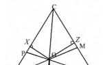
On the concept of relative height. Vertical bidirectional arrows indicate the relative height of one hill relative to any other
Relative height - topographic elevation any point on the earth's surface relative to another point, measured vertically, equal to the difference in the absolute heights of these points (for example, the height mountain top above the bottom of the nearest valley); the vertical distance from the specified source level to the level, point, or object taken as a point.
The higher peak through the base of the saddle is often directly adjacent to the lower peak, but this is not always true in the case of sufficiently deep saddles. Similar cases can only be identified through careful analysis. geographic information. For example:
If the base of a saddle of a mountain is close enough to the peak of that same mountain, the relative height calculation is not particularly difficult and can be done manually using a topographic map.
In more difficult cases, such as those described above, typically use a computer. The USGS uses a special WinProm program written by Edward Earl.
Wikimedia Foundation. 2010 .
See what "Relative Height" is in other dictionaries:
relative height- (T/Wp) Dimensionless value equal to the ratio of the height to the initial width. Note Approximately the relative height of the four types of V-belts is as follows: 0.9 - narrow belt; 0.7 - normal belt; 0.5 - broadened ... ...
Excess (a. relative altitude, relative height; n. relative Hohe; f. altitude relative; and. altura relative), difference abs. heights k. l. points on the earth's surface relative to other points (for example, the height of a mountain peak above the level of the nearest ... ... Geological Encyclopedia
Excess, the difference in absolute heights of any point on the earth's surface relative to another point ... Big Encyclopedic Dictionary
relative height- Difference of absolute heights of two points. Syn.: excess ... Geography Dictionary
Excess, the difference in absolute heights of any point on the earth's surface relative to another point. * * * RELATIVE HEIGHT RELATIVE HEIGHT, excess, difference in absolute heights (see ABSOLUTE HEIGHT) of any point on the earth ... ... encyclopedic Dictionary
Relative height- the height of the terrain point, calculated not from sea level, but from some arbitrary level surface. Sometimes O. in. called the excess of one point over another. For example, the excess of the top of a hill above its sole is called O ... Concise Dictionary operational-tactical and general military terms
The excess of any point on the earth's surface relative to another point, equal to the difference in the absolute heights of these points (for example, the height of a mountain peak above the bottom level of the nearest must) ... Great Soviet Encyclopedia
Exceeding, the difference in absolute heights of k. l. points on the earth's surface relative to other points ... Natural science. encyclopedic Dictionary
Relative height of the compressed zone of concrete- - the ratio of the height of the compressed zone of concrete to the working height of the section. [ Terminological dictionary for concrete and reinforced concrete. Federal State Unitary Enterprise "Research Center" Construction "NIIZHB them. A. A. Gvozdeva, Moscow, 2007, 110 pages] Heading term: Properties of concrete Headings ... ... Encyclopedia of terms, definitions and explanations of building materials
decision altitude (DA) or decision height (DH)- Set altitude or height on a precision approach or approach with vertical guidance at which an aborted approach (go-around) should be initiated if not set ... ... Technical Translator's Handbook